
Strong to Severe Thunderstorms Expected
Jun 16, 2025, 10:03 AM CST
Share
AMERY, Wis. (WLAK) – The risks of large hail, high winds and tornadoes are all possible starting this afternoon and rolling into the night.
Wisconsin is warming up and mugginess is seeping into the state to start the week, creating a perfect mixture to spark strong storms.
Temperatures are tapping the 80s Monday June 16 and dew points are hitting the mid 60s statewide. But in areas near Minneapolis and the St. Croix/Chippewa Valley, dew points are humid and climbing into the low 70s. With a cold front following, it will push clouds high in the sky, spinning them into the potential for severe weather.
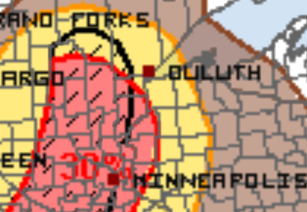
The Storm Prediction Center has put parts of far northwestern Wisconsin under an Enhanced Risk (3 out of 5) for severe weather. There’s a 30% chance for large hail and a 5% chance of a tornado there.
Starting in Minnesota, by 4 PM the first round of rain and thunder should be pushing across the border and into northern Wisconsin. Downpours, gusty winds and hail are all possible.
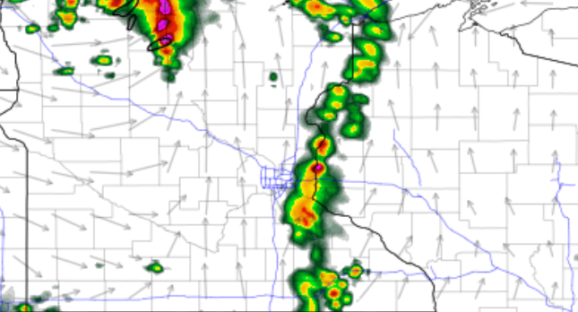
Another potentially stronger round follows later in the evening, around 7 PM. Chances for large hail up to golf ball size is possible, or a tornado and high winds. Stay alert!
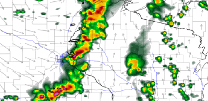
As the storms continue working their way southwestward into the night, they should weaken into central areas but may turn into a line. If that happens, damaging wind gusts up to 60-70 mph would be the biggest risk.
Want More Local News?
Civic Media
Civic Media Inc.
The Civic Media App
Put us in your pocket.

