
Great Lakes ice coverage melts to 2% one of lowest levels ever recorded
Feb 12, 2024, 12:51 PM CT
Share
Milwaukee, Wis. (CIVIC MEDIA) – Scientists say global warming is driving ice loss and warmer water, as ice cover falls short of 50-year average.
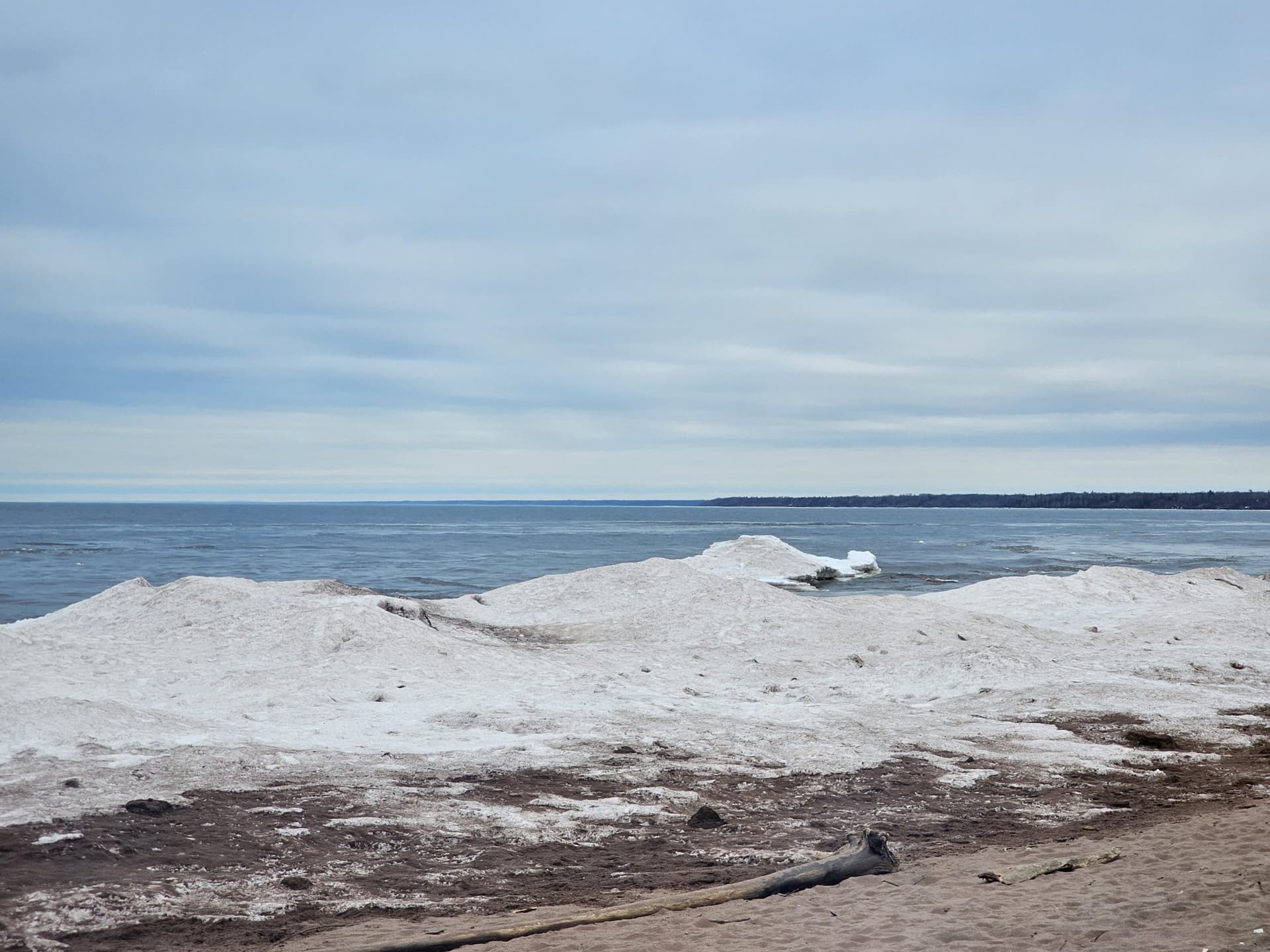
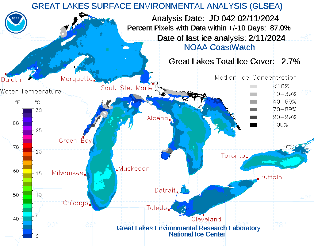
Winter has gone missing, with Spring-like heat taking over in February. Ice on the Great Lakes is now near record-low levels at a mere 2.7% coverage, when it should be approaching 36%. And dozens of cities are on track for one of the warmest winters on record, making snow and ice rare to find.
The classic El Niño pattern coupled with the effects of a warming climate are to blame. Scientists say winter has become the fastest-warming season for nearly 75% of the nation.
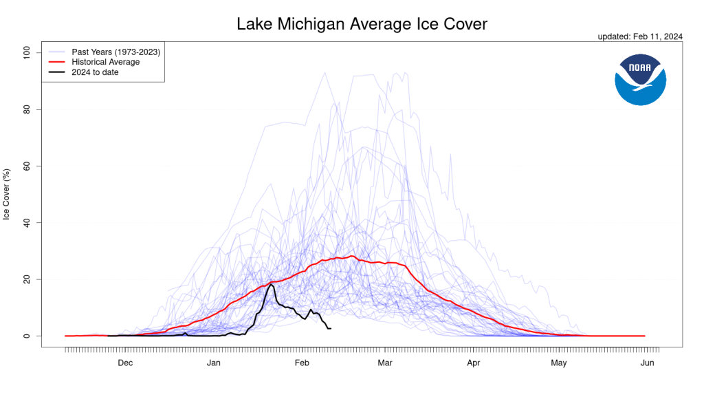
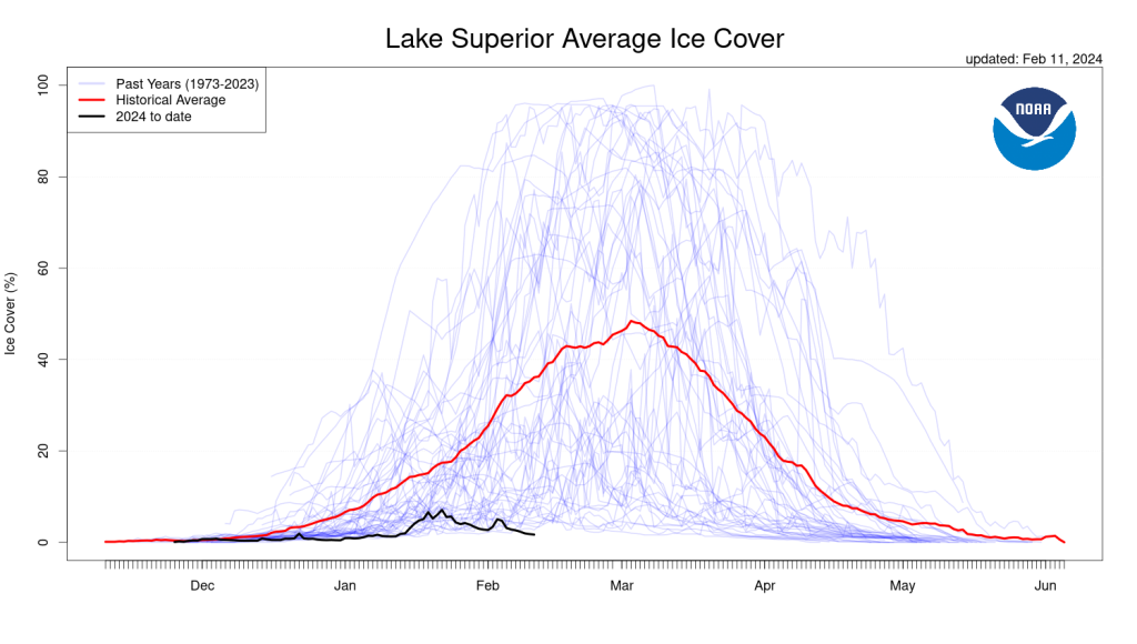
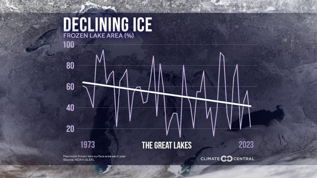
The red line shows where we should be in ice coverage and the black line is where we are currently at. Notice the blue lines, spike even higher but barely scrape the bottom, like we are now.
In years with less or no ice cover, the lakes experience higher evaporation rates, warmer water and lower oxygen levels, making it harder for native coldwater fish to thrive. This causes a ripple effect to the entire food chain. Increased evaporation rates also lead to lower water levels and fewer wetlands in the surrounding areas.
It’s not just the ice missing, it’s the snow too. Wisconsin’s tourism industry is taking a huge hit.
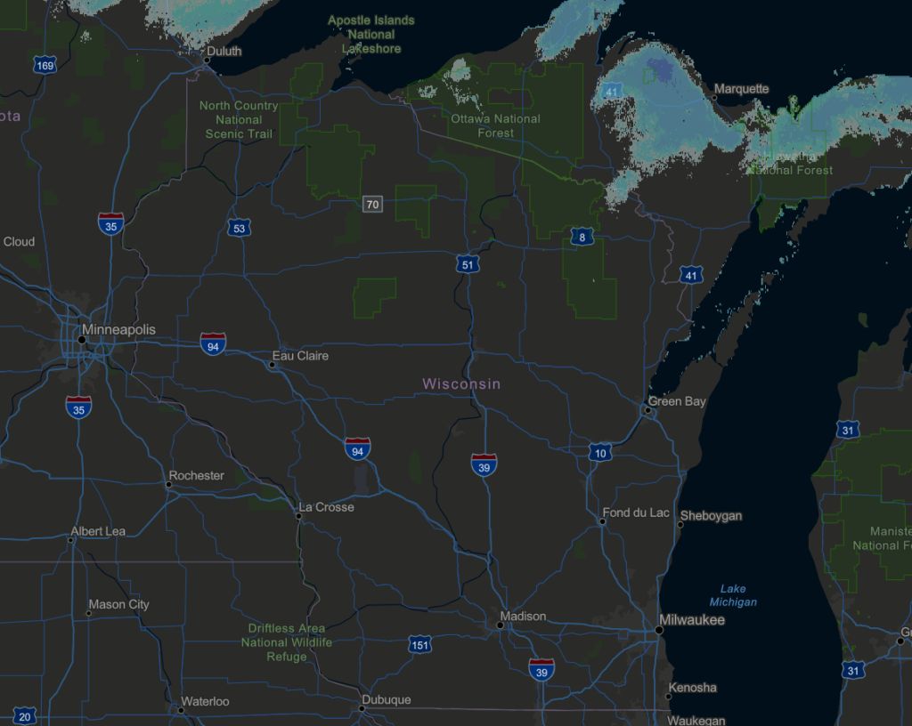
On average, the state sees around 40″ of snow to upwards of nearly 200″ in the snowbelt of Lake Superior. Pictured below is the 2/12/2024 current snow depth.
This year, a town that historically averages around 14 feet of snow has only seen 2 feet. Hurley, Wisconsin the snowmobile capital has only received 32″ of snow, with a max snow cover of 16″ in mid-January. For a town that nears 200″, this puts them at 60% lower than the historical average this far into the winter.
This is because that area called “the snowbelt” is normally pummeled with lake effect snow. Which occurs when cold air blows over the open lake waters. If the air temperatures are 23 degrees colder than the water, you’ll get snow. But the current water temperatures on Lake Superior are approximately 34 degrees. So we would need temperatures of 11 degrees or colder to turn on the lake effect snow machine. Forecasters don’t see that cold of a snap headed our way. But overnight lows will get there this weekend.
Currently, Hurley has only seen a trace of snow so far this month and all of their snowpack has officially melted away, as of today. Putting winter recreation staples like snowmobiling, skiing and snowshoeing on pause.
With the warmth, and lack of ice, it’s also affected inland lakes and activities. Sturgeon spearing season just kicked off this past weekend on Lake Winnebago and many anglers stayed home, as the ice sheet drifted from shore and continues to weaken and melt.
But it’s not just this extreme year making a wave. NOAA says that there seeing a trend of a 5% decline in average ice cover on the Great Lakes, per decade.
With 17 days left in the Meteorological winter and 35 days until the Spring Equinox starts, there are still a few weeks left for snow, cold and ice to make a comeback.
With the trend tipping back to normal, is it too late? Average high temperatures for the end of February in Wisconsin range from the low 30s north to the upper 30s in some southern parts of the state.
However, we all know in Wisconsin, winter storms can strike well into March and even April.
WOW! Incredible snow drift in Oconto Falls, north of Green Bay. Photo from Thomas Thomson #wiwx #AprilBlizzard pic.twitter.com/LINMvtzTxX
— NWS Green Bay (@NWSGreenBay) April 17, 2018
Here’s to hoping – because wildfire season is around the corner and starting Spring in a drought, never ends well.

Brittney Merlot is Civic Media’s Meteorologist. Email her at brittney.merlot@civicmedia.us.
Want More Local News?
Civic Media
Civic Media Inc.
The Civic Media App
Put us in your pocket.
